9 Best Things to Do in Bukit Merah Singapore (2026 Guide)
Bukit Merah is Singapore’s southernmost central planning area and it is one of the most underestimated. Within its 14 square kilometres sit Tiong Bahru’s art deco cafes, Singapore’s largest mall at VivoCity, Henderson Waves bridge, the full Southern Ridges hiking trail, Labrador Nature Reserve, Gillman Barracks’ contemporary art cluster, Alexandra Village Food Centre, and Mount Faber’s cable car. This is not one neighbourhood. It is an entire corridor of Singapore packed with things to do for every type of visitor from early morning hawker breakfasts and gallery afternoons to coastal hikes, cable car rides and some of the city’s most authentic zi char restaurants.
I grew up in Tanjong Pagar, right on the eastern edge of this planning area, and I have lived in Tiong Bahru for the past four years. This guide covers everything worth doing in Bukit Merah organised by area, with honest advice on timing, queues and what to skip.
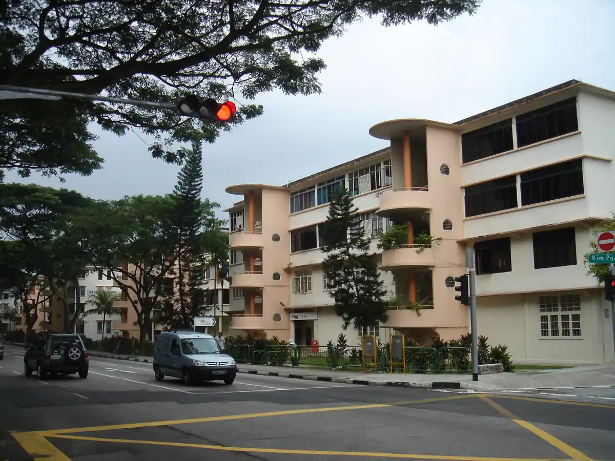
Art deco walk, hawker market, cafes, bookshops. Tiong Bahru is the most discussed neighbourhood in Singapore for a reason. Built in the late 1930s as Singapore’s first public housing estate under the Singapore Improvement Trust, it survived intact while the rest of the island was redeveloped and what survived is the most complete collection of Streamline Moderne architecture in Southeast Asia. The curved forms, the spiral staircases, the covered walkways, the rooftop terraces built for cross-ventilation before air-conditioning existed all of it still standing, still lived in, and now surrounded by the best concentration of independent cafes in any Singapore neighbourhood.
The architecture alone makes Tiong Bahru worth a half-day. Add the two-floor hawker market, the bookshops, the independent boutiques and the general absence of tourist infrastructure, and you have the best single destination in the Bukit Merah planning area by a clear margin. Start at Tiong Bahru Market for breakfast before 9am. Then walk Eng Hoon Street and Yong Siak Street for the densest concentration of art deco shophouses and cafes. Give yourself at least three hours most people underestimate how much is here.
Tiong Bahru Market & Food Centre: two-floor market. Upper floor is wet market; lower floor is the hawker centre with 80+ stalls. The chee cheong fun, lor mee, fishball noodle and chicken rice stalls are the signatures. Go before 10am to beat the queues the market closes early, most stalls wind down by 2pm.
Tiong Bahru Bakery: Singapore’s most famous bakery. The kouign-amann is the signature and worth the queue on weekends. The almond croissant is underrated. The Eng Hoon Street outlet is the original.
Books Actually: independent bookshop on Yong Siak Street, one of the best independent bookshops in Asia. Stocks Singapore literature, poetry, small press titles and postcards you will not find elsewhere. Do not skip it.
Forty Hands: the cafe that started Tiong Bahru’s cafe culture. Flat white, solid eggs, no frills and no pretension. It has been here since 2011 and still does it better than most of the newer places.
Merci Marcel: French bistro on Yong Siak Street. Good for brunch if you want something more substantial than the bakery options. The charcuterie board is the best thing on the menu.
Art deco walking route: Eng Hoon Street, Kim Pong Road and the curved prewar blocks off Tiong Bahru Road. The streamlined facades, curved corners and porthole windows are genuinely unlike anything else in Singapore. Walk the covered walkways designed to let residents move between buildings in the rain without getting wet.
Tiong Bahru Park: small neighbourhood park with a famous spiral slide. Quiet on weekday mornings — good for sitting down after the market and the walk.
Tiong Bahru Plaza: neighbourhood mall with a Golden Village cinema, FairPrice, and food options more resident-oriented than tourist-oriented. The basement food court is solid for a cheap lunch.
Brandon’s Timing Tip
The single best time to visit Tiong Bahru is 7:30–9:30am on a weekday. The market is at full operation, the art deco streets are quiet, and you can get a table at Forty Hands without waiting. Weekend mornings are busy and the bakery queue on Saturdays can stretch 20 minutes. If visiting on a weekend, arrive at the market by 8am or wait until 11am when the breakfast crowd clears.
2. VivoCity & HarbourFront (Singapore’s Largest Mall & Sentosa Gateway)
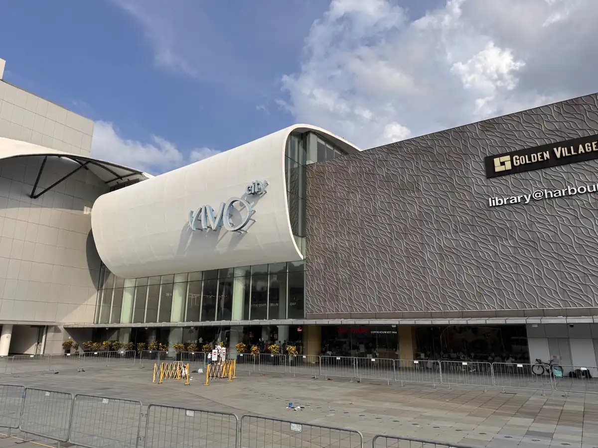
Mall, rooftop, cinema, ferry terminal, Sentosa gateway. VivoCity is Singapore’s largest mall by retail area 140,000 square metres across three floors and the main gateway to Sentosa Island. It sits directly on the waterfront at HarbourFront, connected to the MRT interchange and the Sentosa Express monorail. For visitors coming to this part of Singapore, VivoCity functions as a major logistics hub as much as a shopping destination: this is where you board the cable car, catch the Sentosa Express, find the ferry terminals for Batam and Bintan, and access one of Singapore’s better-value food and dining corridors.
The rooftop Sky Park is VivoCity’s most underrated feature free to access, open-air, with a splash pool for children and genuine views across the Strait of Singapore towards Sentosa and the Batam islands. On a clear day at golden hour this is one of the most accessible waterfront viewpoints in the city.
Rooftop Sky Park: free access, splash pool for children, deckchairs and views across to Sentosa. Best at golden hour (6–7pm) when the light on the water is at its most dramatic. Often overlooked because people assume it costs something it does not.
Golden Village VivoCity: the cinema with Singapore’s largest screen formats at this end of the island. Consistent air-conditioning and good screens. Best for weekday matinees when the mall is quieter.
HarbourFront Walk: the waterfront promenade connecting VivoCity to the cable car station and the ferry terminal. Good for an evening walk after dinner, with shipping lanes and cable car gondolas visible overhead.
Ferry Terminal: direct ferry services to Batam (45 minutes) and Bintan (1 hour) depart from the HarbourFront Ferry Terminal adjacent to the mall. The easiest international day trip from southern Singapore. Buy tickets in advance online.
Sentosa Express: the monorail connecting VivoCity (Level 3) to Sentosa. Single ride ticket or included with Sentosa day passes. First service from 7am, last around midnight.
Food Republic & Kopitiam: the basement food options are the best-value eating at VivoCity. Food Republic has a wide range of local dishes. The kopitiam next to FairPrice Xtra is popular with the lunch crowd.
Don Don Donki: the Japanese discount store in HarbourFront Centre (adjacent to VivoCity) is good for snacks, Japanese products and unusual finds. Open late.
3. Henderson Waves Singapore’s Most Photographed Pedestrian Bridge
Brandon’s Pick
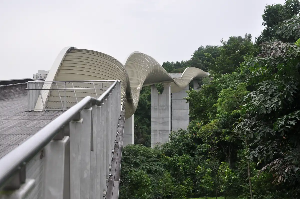
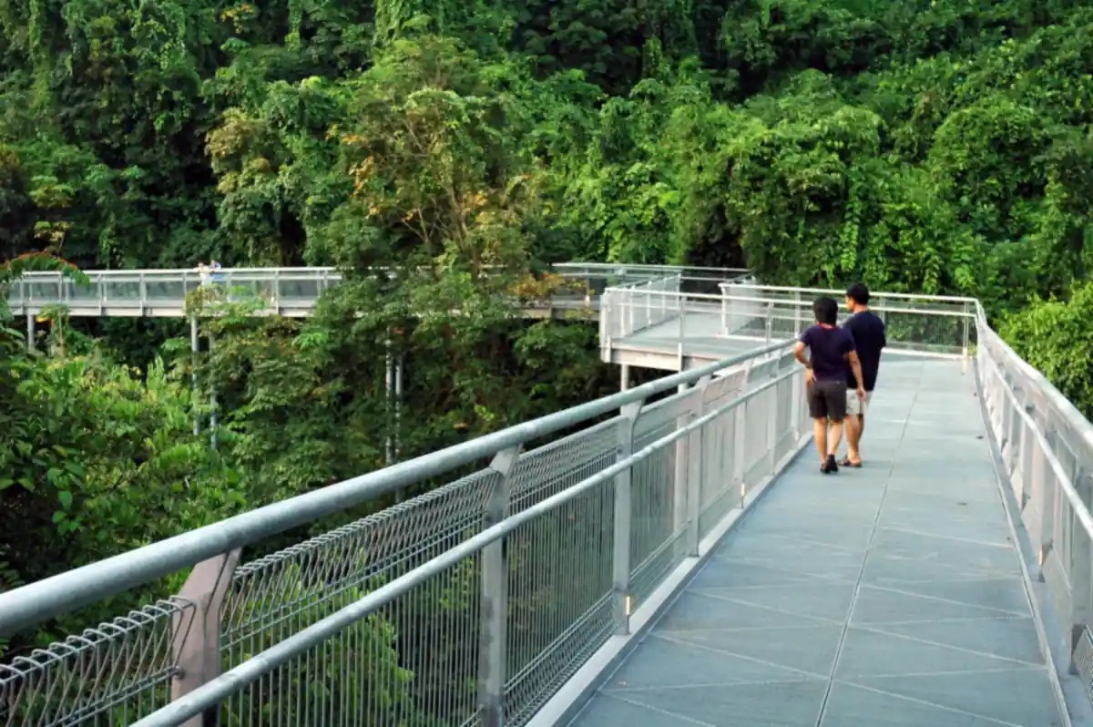
Architecture, sunset photography, night views, trail connection. Henderson Waves is a 274-metre undulating timber pedestrian bridge connecting Mount Faber Park to Telok Blangah Hill at 36 metres above the ground the highest pedestrian bridge in Singapore. The wave-shaped yellow balau wood ribs form nine sheltered alcoves along the walkway, each large enough to sit in and look out through the forest canopy. It is the most photogenic structure on the Southern Ridges trail and one of the most distinctive pieces of public infrastructure design in Singapore.
The bridge is free to walk across at any time of day or night. There is no gate and no closing time. Most photographers come at sunset (6–7pm) for the warm light on the timber, or after dark (8pm onwards) when the LED lighting illuminates the wave forms against the night sky. Both are worth experiencing. Getting there requires a 10-minute walk from the nearest bus stop it sits between Mount Faber Park and Telok Blangah Hill, away from any MRT station. The most common approaches are Bus 195 from Buona Vista or Queenstown MRT, alighting on Henderson Road and walking up the park connector path, or taking the cable car to Mount Faber and walking 20 minutes through the park.
Best photography position: stand on the Telok Blangah Hill end and look back towards Mount Faber to capture the full wave shape. For portraits, the alcoves at the midpoint frame subjects against the forest canopy. Bring a tripod for night shots light levels are low even with the LED installation.
Sunset timing: sunset in Singapore is around 7pm year-round. Arrive by 6pm to find a spot in the alcoves and wait for the golden light. The bridge faces roughly east–west so the western sky lights up behind the Mount Faber tree line.
Trail connections: Henderson Waves is the central connection point of the Southern Ridges trail. HortPark is 15 minutes east on an elevated boardwalk through forest. Mount Faber is 20 minutes west. Telok Blangah Hill summit is 10 minutes uphill from the eastern end.
What to bring: water and trail shoes. The paths leading to the bridge from both sides are paved but uneven in places. No food or drink available at or near the bridge.
4. Southern Ridges (Singapore’s Best Urban Hiking Trail)
10km · Forest Walk · Canopy Boardwalk · Henderson Waves · Mount Faber. A 10-kilometre park connector trail linking Kent Ridge Park, HortPark, Henderson Waves, Telok Blangah Hill Park and Mount Faber Park in a single continuous walk. It is Singapore’s most rewarding urban hiking route not because the terrain is challenging (it is not; this is a well-maintained park connector, not a wilderness trail) but because the combination of secondary forest canopy, elevated boardwalks above the tree line, the Henderson Waves bridge, views over the southern strait and the Keppel container port produce a walk that genuinely does not feel like you are inside one of the world’s densest cities.
The full trail takes 3–4 hours at a comfortable pace. Most visitors who are not doing the complete trail walk the central section HortPark through the Forest Walk and Henderson Waves to Mount Faber which takes about 2 hours and covers all the highlights. Wear trail shoes, bring at least 750ml of water per person (no water points between HortPark and Mount Faber), and go before 10am or after 5pm to avoid the worst of Singapore’s afternoon heat. The trail is well-signed with orange Southern Ridges markers at every junction.
Forest Walk: the elevated boardwalk running from HortPark to Henderson Waves through secondary forest canopy. The quietest and most atmospheric section of the trail. At 1.8km of elevated boardwalk you are above the forest floor but below the tree canopy — a genuinely unusual experience in an urban environment.
Alexandra Arch: the leaf-shaped steel footbridge connecting Alexandra Road to the Southern Ridges at the HortPark entrance. A good photo spot and the clearest signal you have entered the trail from the Alexandra Road side.
HortPark: Singapore’s horticultural park at the eastern anchor of the central section. Themed display gardens, a tool library and a garden centre. Good for families wanting a softer introduction before the full trail.
Telok Blangah Hill summit: the viewing deck has the best unobstructed views over Keppel Harbour and the southern islands. Reach it via the uphill path from the eastern end of Henderson Waves — a steep 10-minute climb but the view is worth it.
Marang Trail: an alternate descent from Telok Blangah Hill that drops steeply through secondary forest towards the Telok Blangah housing estate. More varied terrain and less used, so you’ll often have it to yourself.
Southern Ridges — Recommended Route
Start at Labrador Park MRT (CC26), walk through Labrador Nature Reserve to the Berlayer Creek boardwalk, then continue on the park connector to HortPark. Walk the Forest Walk elevated boardwalk to Henderson Waves, cross the bridge, then climb to Telok Blangah Hill summit before descending to Mount Faber. Take the cable car down to HarbourFront and walk to VivoCity for dinner. Total time: 4–5 hours. This is the most complete version of the southern Singapore green corridor.
5. Mount Faber Park (Cable Car, Hilltop Dining & City Views)
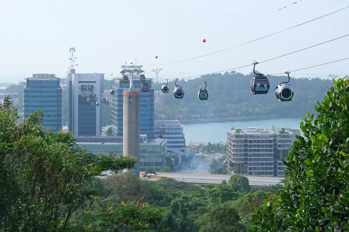
Cable car, summit dining, Safra, night views, trail head. Mount Faber at 105 metres above sea level is not Singapore’s highest point, but it has the best combination of accessibility, infrastructure and views in the southern planning area. The Singapore Cable Car departs from the Faber Peak station at the summit across to Sentosa the only aerial cable car crossing in Singapore. The hilltop cluster at the summit (Faber Peak) has multiple restaurants, a bar, the Bell of Happiness pavilion and panoramic views over the Keppel container port, the southern islands and, on a clear day, the Indonesian island of Batam.
Mount Faber can be reached by cable car from HarbourFront, by car or taxi up the Mount Faber Road summit road, or on foot from Henderson Waves via the Southern Ridges trail (20 minutes). The Safra Mount Faber Club at the base of the hill has a swimming pool, bowling alley and multiple F&B outlets accessible to members and guests.
Singapore Cable Car Mount Faber Line: departs from Faber Peak station and crosses to Sentosa’s Mount Imbiah station. Round-trip tickets around $35 for adults. The crossing takes about 15 minutes. Buy online for discounted rates and to avoid the ticket counter queue.
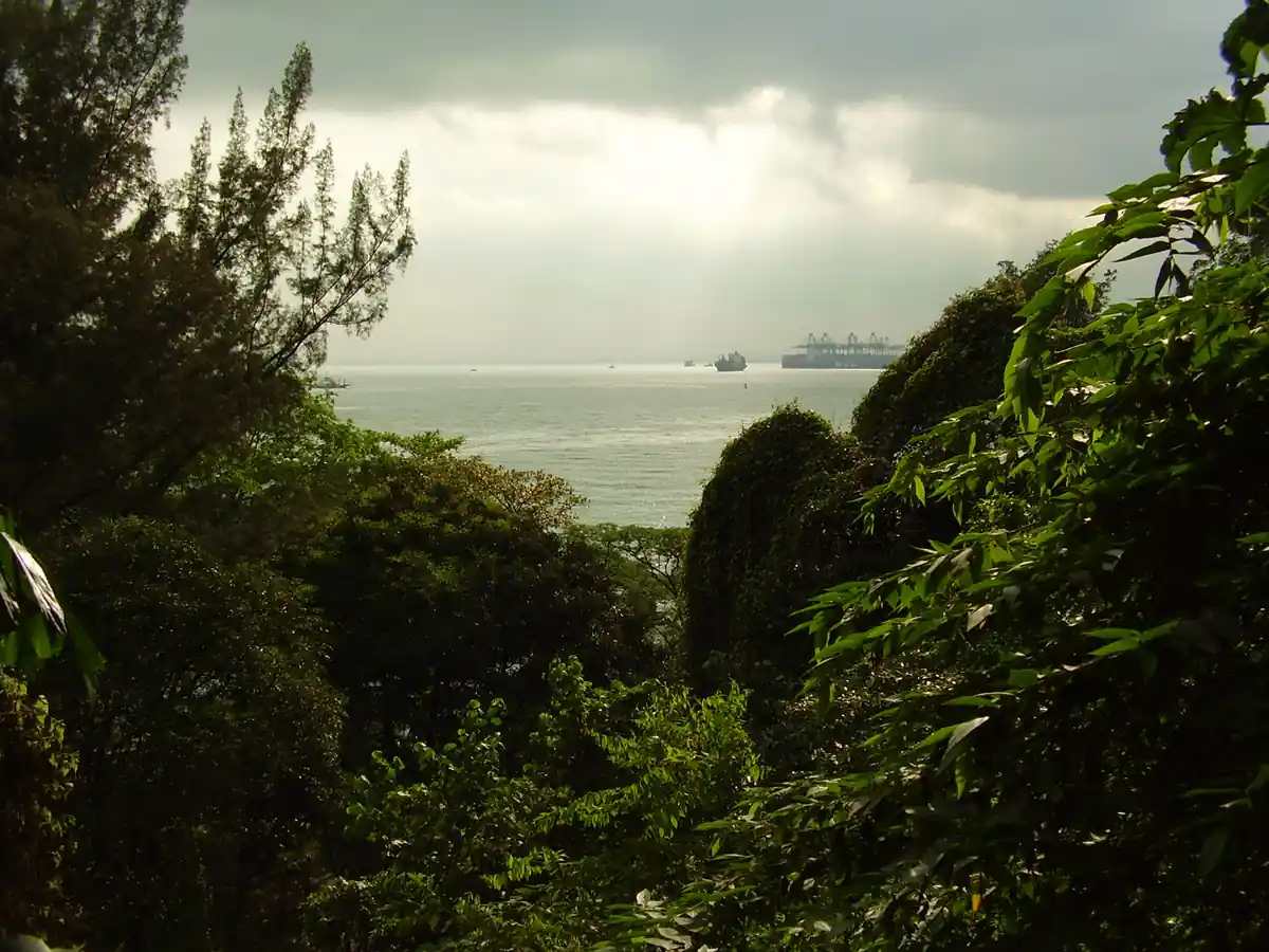
Faber Peak at sunset: the summit viewing area facing south has unobstructed views over the Keppel shipping lanes at the exact time container ships queue for port entry. One of Singapore’s best free views assuming you walk up rather than take the cable car.
Dusk Restaurant & Bar: the signature fine dining restaurant at the summit. Contemporary cuisine with a focus on the view. Reserve well in advance for weekend dinners every table faces the southern horizon.
Arbora Hilltop Garden & Bistro: more casual option at the summit, with garden seating and an all-day menu. Better for a relaxed afternoon drink than a formal dinner.
Cable car history: the system opened in 1974 and suffered a fatal accident in 1983 when a derrick barge struck a cable, causing three gondolas to fall six people died. The system was rebuilt and has operated safely since, but the 1983 incident is part of Singapore’s memory.
Safra Mount Faber: the National Service club at the base of the hill. A 50-metre outdoor pool, bowling alley, futsal courts and multiple food outlets open to SAF members and their families.
6. Labrador Nature Reserve Fort Ruins, Coastal Trail & WWII History
Fort ruins, coastal walk, WWII history, mangroves. Labrador Park is the only rocky coastal cliff nature reserve in Singapore and the least visited of the major Bukit Merah destinations. It combines a Victorian-era gun battery with WWII defensive fortifications, a secondary forest nature trail, a coastal cliff walk, a mangrove boardwalk at Berlayer Creek, and views across the Keppel Strait that put you at sea level rather than elevated above it a genuinely different experience from the hilltop views at Mount Faber and Telok Blangah.
The historical layer is significant and worth engaging with before you visit. The gun battery at Fort Pasir Panjang was built in the 1880s as part of the British coastal defence network the guns faced south, towards the sea, because the strategic assumption was that any attack on Singapore would come by sea from the south. In February 1942 the Japanese Imperial Army attacked overland from the north through Malaya. The guns that were supposed to defend Singapore were pointing in the wrong direction.
Labrador Park MRT (CC26) is a 10-minute walk from the main park entrance on Labrador Villa Road. The fort ruins and coastal trail are free to explore. The full loop of the coastal trail and Berlayer Creek boardwalk takes about 1.5 hours. Bring insect repellent the mangrove section has mosquitoes in the early morning and late afternoon.
Fort Pasir Panjang gun battery: the original British defensive fortifications from the 1880s, preserved along the coastal cliff. Gun emplacements, ammunition stores and observation posts are open to walk through, with interpretive panels explaining the fort’s history and the 1942 Fall of Singapore.
Coastal cliff walk: the path along the Labrador cliff edge with views across the strait to Sentosa and the container shipping lanes. One of the few places in Singapore where you see the sea at roughly eye level rather than from above.
Berlayer Creek boardwalk: a 200-metre elevated boardwalk through the mangrove fringe adjacent to the park. Herons, mudskippers, fiddler crabs and the sound of the city fading a genuinely intact mangrove ecosystem this close to central Singapore.
Labrador Tower: the restored colonial-era water tower at the park entrance, converted into a visitor landmark the most recognisable landmark at the Labrador Villa Road entrance.
Park connector to Southern Ridges: Labrador Park connects directly to the Southern Ridges park connector heading north towards HortPark and Henderson Waves.
7. Alexandra & Gillman Barracks (Hawker, Art & Colonial History)
Brandon’s Pick
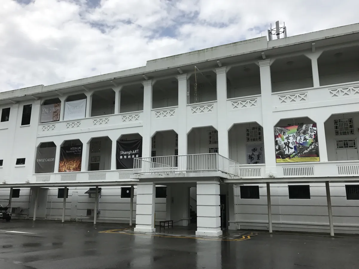
Hawker centre, zi char, art galleries, colonial buildings, IKEA. The Alexandra Road corridor is Bukit Merah’s most local section almost entirely resident-facing, with almost no tourist infrastructure, which is exactly where the best food and the most interesting cultural destinations tend to cluster in Singapore. Alexandra Village Food Centre is one of the city’s great hawker destinations. Keng Eng Kee Seafood, 200 metres away on the same road, is one of Singapore’s most famous zi char restaurants. Gillman Barracks, a 10-minute walk south, is a former British military barracks from 1936 that now houses 15+ contemporary art galleries in the most atmospherically preserved colonial military buildings still standing in Singapore.
The best way to do both in a single visit: lunch at Alexandra Village Food Centre or Keng Eng Kee (book ahead for the latter, especially on weekends), then walk or grab a short taxi to Gillman Barracks for the afternoon galleries. Most galleries are open Tuesday to Sunday with free entry.
Alexandra Village Food Centre: one of the most respected hawker centres in Singapore among residents. Han Dynasty is the name-checked zi char stall, but multiple strong stalls exist across different dishes. Weekday evenings are the quietest, best time to visit.
Keng Eng Kee Seafood: one of Singapore’s most famous zi char restaurants, operating from a shophouse on Bukit Merah Lane 1 since 1970. Cereal butter prawns, claypot frog legs and moonlight hor fun are the signatures. A table of four spends $80–$120 book in advance, especially on weekends.
Gillman Barracks: 15+ contemporary art galleries including Sundaram Tagore, Sullivan+Strumpf and other internationally recognised names, housed in 1936 colonial military barracks buildings. The architecture single-storey brick buildings with wide verandahs is as interesting as the art. Most galleries are free entry.
Hopscotch at Gillman Barracks: the standout restaurant, serving modern bistro food in a converted colonial building. One of the better lunch options in the area for a sit-down meal.
IKEA Alexandra: five minutes along Alexandra Road from the food centre. The food hall serves Swedish meatballs, soft-serve ice cream and hot dogs at prices lower than most hawker options.
Alexandra Canal Linear Park: the park connector running along the Alexandra Canal is a good cycling and walking route connecting the Alexandra area to Queenstown and Holland Village.
8. Everton Park & Redhill (Shophouse Cafes & Old Singapore)
Shophouse cafes, old Singapore HDB, hawker centre, local character. Everton Park and Redhill are the two most overlooked destinations in the Bukit Merah planning area which is exactly why they are worth including in any serious itinerary of the corridor. Everton Park is a 1960s HDB estate of shophouses on the eastern edge of Bukit Merah, adjacent to Outram Park MRT, that has quietly developed into one of Singapore’s most interesting cafe neighbourhoods. Redhill is old Singapore an HDB residential area built around the legend of the red hill, with a hawker centre, a market and an MRT station connecting the entire southern corridor to the rest of the city.
Everton Park is a 10-minute walk from Outram Park MRT (EW16/NE3/TE17) or a 5-minute walk from Tiong Bahru MRT. Redhill MRT (EW18) is the main transport hub for the Redhill and Bukit Merah residential areas. The Redhill Food Centre is a 5-minute walk from the MRT station.
Everton Park cafes: the ground-floor shophouse units of the Everton Park HDB blocks have been gradually taken over by independent cafes, bakeries and coffee roasters over the past decade. Between Two Buns (gourmet burgers), Hello Arigato (Japanese-inspired coffee and desserts) and several specialty coffee operators give the estate an unexpectedly strong cafe scene.
Everton Park shophouse architecture: the 1960s blocks have a different character from Tiong Bahru’s 1930s art deco buildings more functional, less ornamented, but with a particular HDB brutalism worth appreciating as a different chapter of Singapore’s public housing history.
Redhill Food Centre & Market: a resident hawker centre with no tourist crowd and genuinely good food. Worth visiting specifically for the lor mee and kway chap. The morning wet market upstairs is one of the last traditional Bukit Merah fresh markets still operating at full capacity.
Redhill legend: the red hill (Bukit Merah) takes its name from a local legend about a boy who saved the kampung from an attack of swordfish. The story is taught in Singapore schools and is part of the local cultural memory of the area.
Best Hawker Centres in Bukit Merah
Bukit Merah has a stronger hawker culture than almost any other planning area in Singapore. These are the four worth building a visit around, ranked by what makes each one distinct.
🏆 Best Breakfast
Tiong Bahru Market & Food Centre
Two-floor market. Upper floor wet market, lower floor 80+ hawker stalls. Chee cheong fun, lor mee, fishball noodle and chicken rice are Singapore-famous. Best before 10am — stalls run out by early afternoon.
📍 Tiong Bahru🕕 6am–2pmMRT EW17
🏆 Best Zi Char
Alexandra Village Food Centre
One of Singapore’s most respected resident hawker centres. Han Dynasty zi char is the signature. Not tourist-facing — exactly why the food is better and prices are lower.
📍 Alexandra🕕 Lunch & DinnerBus 14
Most Local
Bukit Merah View Market & Hawker Centre
Almost entirely Bukit Merah residents, zero tourists. The kway chap and carrot cake stalls are the signatures. Best early morning when freshest.
📍 Bukit Merah🕕 6am–2pmBus 122
Best Post-Hike
Telok Blangah Rise Food Centre
At the base of Telok Blangah Hill — the natural refuelling stop before or after the Southern Ridges hike. Sum Kee Food’s crab bee hoon is the reason to go.
📍 Telok Blangah🕕 Lunch & DinnerMRT CC27
Suggested Itineraries for Bukit Merah
Bukit Merah is a large planning area the distance from Tiong Bahru to Labrador Park is around 6 kilometres, and the hills mean walking between locations is not always practical. Here are three itinerary structures depending on how much time you have.
Half-Day Tiong Bahru Only (4–5 hours)
7:30–9:30am
Tiong Bahru Market — breakfast, chee cheong fun + kopi
9:30–11:30am
Art Deco Walk — Eng Hoon St + Yong Siak St
11:30am–1pm
Cafes & Books — Forty Hands + Books Actually
1pm onward
Tiong Bahru Plaza — lunch + MRT out
Full Day Tiong Bahru + Henderson Waves + VivoCity (9–10 hours)
7:30–10am
Tiong Bahru Market + Walk — breakfast + art deco streets
10am–1pm
Henderson Waves Hike — Bus 195 → trail → bridge
1–3pm
Lunch + Rest — Telok Blangah Rise Food Centre
3–8pm
VivoCity + Rooftop Sunset — mall + Sky Park at golden hour
Two Days Complete Bukit Merah Corridor
Day 1: Tiong Bahru market breakfast → art deco walk → VivoCity afternoon → Henderson Waves at sunset → cable car to HarbourFront → dinner at VivoCity or Telok Blangah Rise Food Centre.
Day 2: Alexandra Village Food Centre lunch → Keng Eng Kee dinner (booked in advance) → Gillman Barracks afternoon galleries → Labrador Park coastal walk in the late afternoon → finish at Everton Park for a post-walk coffee.
Getting Around Bukit Merah
Bukit Merah is large and hilly. The MRT covers the perimeter well but the interior including Henderson Waves, Gillman Barracks and Mount Faber requires buses, taxis or walking.
🚇 MRT stations: Tiong Bahru (EW17) · Redhill (EW18) · HarbourFront (CC29/NE1) · Telok Blangah (CC27) · Labrador Park (CC26) · Haw Par Villa (CC25)
🌉 To Henderson Waves: Bus 195 from Buona Vista/Queenstown MRT, alight on Henderson Rd, 10-min walk. Or cable car to Mount Faber, 20-min walk.
🎨 To Gillman Barracks: No direct MRT. Taxi/Grab from Labrador Park MRT (~5 min, ~$6). Or Bus 175 along Alexandra Road.
🚡 To Mount Faber: Cable car from HarbourFront MRT (fastest). Or drive/taxi to the summit carpark. Or walk from Henderson Waves (20 min).
🅿️ Parking: VivoCity has the largest carpark — busy on weekends, use the Level 1 entrance off HarbourFront Avenue. Mount Faber has free weekend parking at the summit.
⏱️ Time to allow: Half day for Tiong Bahru only. Full day for Tiong Bahru + Henderson Waves + VivoCity. Two full days to add Labrador, Gillman Barracks, Alexandra and Everton Park.
Cable car, sunset dining, night views, trail access
Cable car from HarbourFront
2–3 hours
Labrador Park
WWII fort history, coastal walk, mangroves, quiet
MRT CC26 + 10 min walk
1.5–2.5 hours
Alexandra
Hawker food, zi char, IKEA, local eating
Bus 14 from Queenstown/Tiong Bahru MRT
1.5–2 hours
Gillman Barracks
Contemporary art galleries, colonial architecture
Taxi from Labrador Park MRT
2–3 hours
Everton Park
Shophouse cafes, local character, coffee
Walk from Outram Park MRT
1–2 hours
Frequently Asked Questions
Bukit Merah is known for Tiong Bahru’s art deco architecture and cafe scene, VivoCity (Singapore’s largest mall and Sentosa gateway), Henderson Waves bridge, the Southern Ridges hiking trail, Mount Faber’s cable car, Labrador Nature Reserve’s WWII fort ruins, and Gillman Barracks’ contemporary art galleries housed in colonial military buildings.
A half day covers Tiong Bahru alone. A full day (9–10 hours) covers Tiong Bahru, Henderson Waves and VivoCity together. Two full days lets you add Labrador Nature Reserve, Gillman Barracks, Alexandra Village Food Centre and Everton Park for the complete Bukit Merah corridor.
Yes Bukit Merah offers a rare combination for a single Singapore planning area: heritage architecture (Tiong Bahru), Singapore’s largest mall and Sentosa access (VivoCity), a genuinely rewarding urban hiking trail (Southern Ridges), WWII history (Labrador Park), and contemporary art (Gillman Barracks) — most of it with significantly fewer tourists than the city centre.
Tiong Bahru is the best starting point for a first-time visit — it’s the most complete single destination, has excellent MRT access (EW17), and works well as either a half-day trip on its own or the anchor for a fuller Bukit Merah itinerary. Arrive by 7:30–9:30am for the hawker market at its best.
Bukit Merah is the larger planning area (14 square kilometres) that contains Tiong Bahru along with VivoCity, Henderson Waves, Mount Faber, Labrador Park, Alexandra, Gillman Barracks, Everton Park and Redhill. Tiong Bahru is one specific neighbourhood within it — the art deco heritage estate with the famous hawker market and cafe scene.
Brandon’s Verdict
One planning area, seven completely different Singapores
What I keep coming back to about Bukit Merah, four years into living here, is how little it repeats itself. Tiong Bahru’s art deco calm has nothing in common with VivoCity’s mall energy, which has nothing in common with the quiet dignity of the Labrador fort ruins, which has nothing in common with the industrial-scale views from Mount Faber. Most Singapore neighbourhoods have a single character. Bukit Merah has at least seven, and they’re all within a 15-minute Grab of each other.
If you only have one day, do Tiong Bahru in the morning and Henderson Waves at sunset — that combination alone justifies the trip. If you have two days, add Labrador Park and Gillman Barracks, and you’ll leave having seen a side of Singapore that most visitors, and a lot of residents, never bother to find.